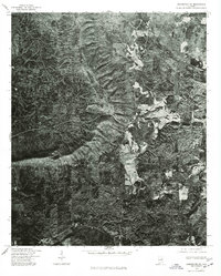
1975 Map of Goodwater NE
USGS Topo · Published 1977About this map
Shady Grove and the surrounding woodlands of Clay County are captured in this mid-1970s orthophotograph, providing a unique aerial perspective of the rural Alabama landscape. Unlike traditional line-and-symbol maps, this survey uses direct imagery to show the actual footprint of clearings, farmsteads, and timber tracts during a period of steady agricultural and forestry use. The small settlement of Midway appears in the southern portion of the sheet, connected by winding country roads that follow the natural topography of the ridges. To the east, the clearing of Brownsville stands out against the dense forest cover. This specific format was produced by the U.S. Geological Survey in cooperation with the Soil Conservation Service, making it a valuable tool for understanding land use patterns and field boundaries as they existed nearly fifty years ago.
Find a feature on this map
3 named features on this map. Tap any name to fly to it.
Don’t see what you’re looking for? This feature index may not catch every label — zoom into the map to look around manually.
Map Details
Editions of this 1975 Goodwater NE Map
This is the sole edition of this map. No revisions or reprints were ever made.
Other maps of this area

1890 · Talladega
USGS Topo · 1:125,000

1891 · Ashland
USGS Topo · 1:125,000

1892 · Talladega
USGS Topo · 1:125,000

1943 · Talladega
USGS Topo · 1:62,500

1944 · Goodwater
USGS Topo · 1:62,500

1946 · Talladega
USGS Topo · 1:62,500

1947 · Goodwater
USGS Topo · 1:62,500

1953 · Birmingham
USGS Topo · 1:250,000

1953 · Atlanta
USGS Topo · 1:250,000

1956 · Birmingham
USGS Topo · 1:250,000