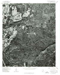
1975 Map of Goodwater NW
USGS Topo · Published 1977About this map
Sylacauga anchors the western edge of this mid-1970s orthophotograph, where the transition from organized town grids to the dense, wooded hills of Talladega County is captured in sharp aerial detail. Unlike standard topographic sheets, this orthophotoquad provides a direct visual of the land cover and vegetation patterns during a period of steady growth for the region. To the north, the settlement of Sycamore sits along a primary transportation corridor, surrounded by a complex network of timberlands and small clearings. The imagery reveals the intricate drainage patterns and ridge-and-valley topography that define the landscape between these two communities, offering a clear record of residential footprints and forest management at the time the aerial photograph was taken in late 1975.
Find a feature on this map
2 named features on this map. Tap any name to fly to it.
Don’t see what you’re looking for? This feature index may not catch every label — zoom into the map to look around manually.
Map Details
Editions of this 1975 Goodwater NW Map
This is the sole edition of this map. No revisions or reprints were ever made.
Other maps of this area

1890 · Talladega
USGS Topo · 1:125,000

1892 · Talladega
USGS Topo · 1:125,000

1915 · Gantts Quarry
USGS Topo · 1:48,000

1917 · Gantts Quarry
USGS Topo · 1:62,500

1943 · Talladega
USGS Topo · 1:62,500

1944 · Goodwater
USGS Topo · 1:62,500

1946 · Talladega
USGS Topo · 1:62,500

1947 · Goodwater
USGS Topo · 1:62,500

1953 · Birmingham
USGS Topo · 1:250,000

1956 · Birmingham
USGS Topo · 1:250,000