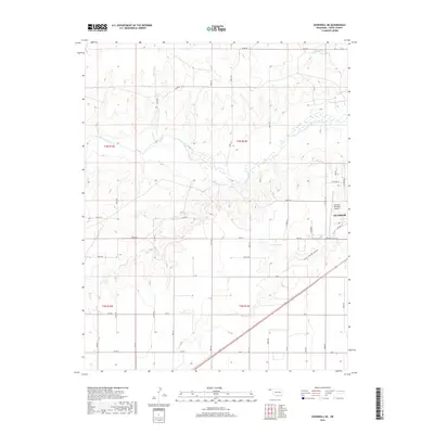
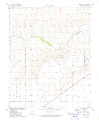
2018 Map of Goodwell NE
USGS Topo · Published 2018About this map
Guymon marks the southeastern corner of this Oklahoma Panhandle survey, where residential streets like Mike Dr and W Indian Hills St meet the open high plains. The landscape is defined by the winding course of the Beaver River, which cuts a broad valley across the northern half of the quadrangle. This drainage system, joined by Little Goff Creek and the southern Dry Sand Draw, creates the primary topographical relief in an otherwise flat agricultural expanse. Infrastructure centers on the Guymon Municipal Airport and a grid of section-line roads, such as Co Hwy 31 and Mile 26, which facilitate the region’s transport and ranching operations. The map details the transition from the concentrated town site of Guymon to the vast, open acreage of the surrounding townships.
Find a feature on this map
45 named features on this map. Tap any name to fly to it.
Don’t see what you’re looking for? This feature index may not catch every label — zoom into the map to look around manually.
Map Details
Editions of this 2018 Goodwell NE Map
This is the sole edition of this map. No revisions or reprints were ever made.
Other maps of this area

1954 · Perryton
USGS Topo · 1:250,000

1958 · Perryton
USGS Topo · 1:250,000
1967 · Straight SW
USGS Topo · 1:24,000
1968 · Guymon
USGS Topo · 1:24,000
1968 · Guymon SW
USGS Topo · 1:24,000
1973 · Goodwell SE
USGS Topo · 1:24,000
1973 · Goodwell NW
USGS Topo · 1:24,000
1973 · Hough SW
USGS Topo · 1:24,000
1973 · Goodwell
USGS Topo · 1:24,000
1973 · Goodwell NE
USGS Topo · 1:24,000