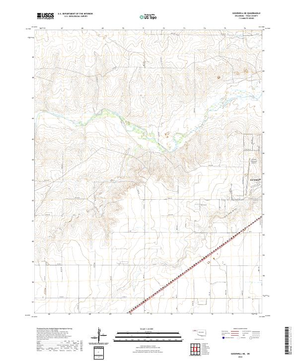
2022 Map of Goodwell NE
USGS Topo · Published 2022About this map
Beaver River meanders across this High Plains landscape, carving a low valley through the northern sections of the survey. The terrain is characterized by the wide, sandy drainage of Dry Sand Draw to the south and the smaller channel of Little Goff Creek near the northern boundary. The edge of Guymon occupies the southeastern corner of the map, marking the transition from the city's developed outskirts to the surrounding agricultural grid of Texas County.
Find a feature on this map
24 named features on this map. Tap any name to fly to it.
Don’t see what you’re looking for? This feature index may not catch every label — zoom into the map to look around manually.
Map Details
Editions of this 2022 Goodwell NE Map
This is the sole edition of this map. No revisions or reprints were ever made.
Other maps of this area

1954 · Perryton
USGS Topo · 1:250,000

1958 · Perryton
USGS Topo · 1:250,000

1967 · Straight SW
USGS Topo · 1:24,000

1968 · Guymon
USGS Topo · 1:24,000

1968 · Guymon SW
USGS Topo · 1:24,000

1973 · Goodwell SE
USGS Topo · 1:24,000

1973 · Goodwell NW
USGS Topo · 1:24,000

1973 · Hough SW
USGS Topo · 1:24,000

1973 · Goodwell
USGS Topo · 1:24,000

1973 · Goodwell NE
USGS Topo · 1:24,000