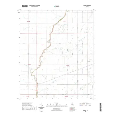
2020 Map of Goodwill
USGS Topo · Published 2020About this map
The Goodwill settlement occupies a central position within this northeastern Louisiana landscape, where the meandering Boeuf River defines the boundary between Morehouse and West Carroll Parishes. The terrain is characterized by an intricate drainage network of slow-moving waterways, including Threemile Slough, Fivemile Slough, and Rising Slough, which weave through the agricultural tracts. This 2020 survey illustrates a highly developed grid of parish roads that provide access to the various sections of the Public Land Survey System, such as Township 21 North, Range 9 East.
Find a feature on this map
51 named features on this map. Tap any name to fly to it.
Don’t see what you’re looking for? This feature index may not catch every label — zoom into the map to look around manually.
Map Details
Editions of this 2020 Goodwill Map
This is the sole edition of this map. No revisions or reprints were ever made.
Other maps of this area

1935 · Hurricane
USGS Topo · 1:62,500

1935 · Oak Grove
USGS Topo · 1:62,500

1935 · Bonita
USGS Topo · 1:62,500

1955 · Jackson
USGS Topo · 1:250,000

1958 · Oak Grove
USGS Topo · 1:62,500

1958 · Hurricane
USGS Topo · 1:62,500

1958 · Bonita
USGS Topo · 1:62,500

1959 · Mitchiner
USGS Topo · 1:62,500

1961 · Jackson
USGS Topo · 1:250,000

1962 · Jackson
USGS Topo · 1:250,000