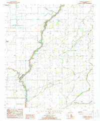
1988 Map of Goodwill
USGS Topo · Published 1988About this map
The Boeuf River carves a winding path along the boundary between Morehouse Parish and West Carroll Parish, serving as the central geographic feature of this delta landscape in the late 1980s. The settlement of Goodwill sits within a complex network of drainage systems, including Fluemile Slough and Rising Slough, which illustrate the region's historical reliance on water management for agriculture.
Find a feature on this map
12 named features on this map. Tap any name to fly to it.
Don’t see what you’re looking for? This feature index may not catch every label — zoom into the map to look around manually.
Map Details
Editions of this 1988 Goodwill Map
This is the sole edition of this map. No revisions or reprints were ever made.
Other maps of this area

1935 · Hurricane
USGS Topo · 1:62,500

1935 · Oak Grove
USGS Topo · 1:62,500

1935 · Bonita
USGS Topo · 1:62,500

1955 · Jackson
USGS Topo · 1:250,000

1958 · Oak Grove
USGS Topo · 1:62,500

1958 · Hurricane
USGS Topo · 1:62,500

1958 · Bonita
USGS Topo · 1:62,500

1959 · Mitchiner
USGS Topo · 1:62,500

1961 · Jackson
USGS Topo · 1:250,000

1962 · Jackson
USGS Topo · 1:250,000