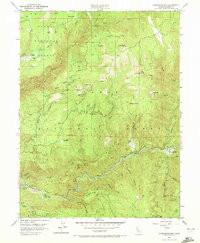
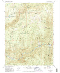
1951 Map of Goodyears Bar
USGS Topo · Published 1972About this map
Gold mining legacies and remote Sierra Nevada settlements define this mid-century portrait of northern California. The North Fork Yuba River carves a deep path through the landscape, flanked by the Tahoe National Forest and Plumas National Forest. At the confluence of Goodyears Creek stands Goodyears Bar, a focal point of activity near numerous extraction sites. The map documents an industrial transition, noting both active operations and former works such as the Magnolia Mine (Site), Bunker Hill Mine (Site), and McMahon Mine.
Find a feature on this map
48 named features on this map. Tap any name to fly to it.
Don’t see what you’re looking for? This feature index may not catch every label — zoom into the map to look around manually.
Map Details
Editions of this 1951 Goodyears Bar Map
5 editions found
Other maps of this area

1888 · Smartsville
USGS Topo · 1:125,000

1888 · Bidwell Bar
USGS Topo · 1:125,000

1891 · Bidwell Bar
USGS Topo · 1:125,000

1891 · Downieville
USGS Topo · 1:125,000

1891 · Colfax
USGS Topo · 1:125,000

1891 · Smartsville
USGS Topo · 1:125,000

1892 · Smartsville
USGS Topo · 1:125,000

1892 · Colfax
USGS Topo · 1:125,000

1893 · Bidwell Bar
USGS Topo · 1:125,000

1893 · Downieville
USGS Topo · 1:125,000