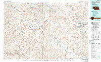
1985 Map of Goose Creek
USGS Topo · Published 1994About this map
The Valentine National Wildlife Refuge dominates this section of the Nebraska Sandhills, preserving a landscape characterized by its unique interdunal wetlands and lakes. The water-rich environment is evidenced by dozens of named bodies such as Dads Lake, Moon Lake, and Bull Lake, alongside specialized conservation zones like the Rat and Beaver Lake State Wildlife Management Area. Human settlement is concentrated in small outposts including Purdum, Elsmere, and Koshopah, while the southern reaches show the influence of the Middle Loup River and the Burlington Northern railroad near Seneca. The intricate drainage patterns of Goose Creek and North Loup River cut through valleys like Calf Creek Valley and Wamaduze Valley, illustrating the hydrological complexity of the region before late-20th-century shifts in land use.
Find a feature on this map
49 named features on this map. Tap any name to fly to it.
Don’t see what you’re looking for? This feature index may not catch every label — zoom into the map to look around manually.
Map Details
Editions of this 1985 Goose Creek Map
2 editions found

Other maps of this area

1947 · Dismal River Ranch
USGS Topo · 1:62,500

1948 · Seneca
USGS Topo · 1:62,500

1948 · Thedford
USGS Topo · 1:62,500

1948 · Mullen
USGS Topo · 1:62,500

1948 · Halsey
USGS Topo · 1:62,500

1948 · Seneca 4
USGS Topo · 1:62,500

1949 · Seneca 4
USGS Topo · 1:62,500

1949 · Dismal River Ranch
USGS Topo · 1:62,500

1949 · Big Falls
USGS Topo · 1:62,500

1949 · Purdum
USGS Topo · 1:62,500