
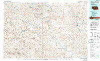
1985 Map of Goose Creek
USGS Topo · Published 1985About this map
The sprawling sandhills of central Nebraska dominate this 1985 survey, where the Goose Creek and North Loup River systems carve distinct paths through a landscape defined by thousands of wetlands. The Valentine National Wildlife Refuge and numerous wildlife management areas like Rat and Beaver Lake State Wildlife Management Area underscore the importance of this region as a migratory corridor. Small settlements such as Brownlee and Elsmere remain remote, connected by light-duty roads and the primary north-south corridor of Highway 83.
Find a feature on this map
86 named features on this map. Tap any name to fly to it.
Don’t see what you’re looking for? This feature index may not catch every label — zoom into the map to look around manually.
Map Details
Editions of this 1985 Goose Creek Map
2 editions found
Other maps of this area

1947 · Dismal River Ranch
USGS Topo · 1:62,500

1948 · Seneca
USGS Topo · 1:62,500

1948 · Thedford
USGS Topo · 1:62,500

1948 · Mullen
USGS Topo · 1:62,500

1948 · Halsey
USGS Topo · 1:62,500

1948 · Seneca 4
USGS Topo · 1:62,500

1949 · Seneca 4
USGS Topo · 1:62,500

1949 · Dismal River Ranch
USGS Topo · 1:62,500

1949 · Big Falls
USGS Topo · 1:62,500

1949 · Purdum
USGS Topo · 1:62,500