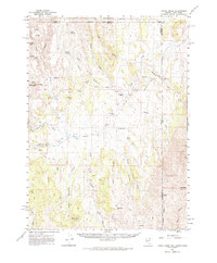
1961 Map of Goose Creek
USGS Topo · Published 1963About this map
The Old Emigrant Trail cuts a historic path across this high-desert landscape where the borders of Nevada, Idaho, and Utah meet. Surveyed in the early 1960s, the terrain is defined by the drainage of Goose Creek and its many tributaries, including East Fork and West Fork. The map documents a sparse ranching economy through isolated outposts like Rancho Grande, Trout Creek Ranch, and Judd Ranch. These settlements are connected by a network of trails and unimproved roads that navigate significant geographical obstacles such as Wagon Box Pass and Deans Pass. To the north, the Sawtooth National Forest boundary marks a transition in land use, while prominent landmarks like Sugar Loaf Peak and Judd Mtn provide essential orientation for travelers in this remote tri-state corner.
Find a feature on this map
40 named features on this map. Tap any name to fly to it.
Don’t see what you’re looking for? This feature index may not catch every label — zoom into the map to look around manually.
Map Details
Editions of this 1961 Goose Creek Map
3 editions found

Other maps of this area

1954 · Pocatello
USGS Topo · 1:250,000

1954 · Brigham City
USGS Topo · 1:250,000

1955 · Twin Falls
USGS Topo · 1:250,000

1955 · Wells
USGS Topo · 1:250,000

1958 · Wells
USGS Topo · 1:250,000

1958 · Twin Falls
USGS Topo · 1:250,000

1958 · Pocatello
USGS Topo · 1:250,000

1958 · Brigham City
USGS Topo · 1:250,000

1959 · Cotton Thomas Basin
USGS Topo · 1:62,500

1961 · Wells
USGS Topo · 1:250,000