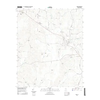
2014 Map of Gordo
USGS Topo · Published 2014About this map
Gordo and Reform serve as the primary hubs in this part of Pickens County, connected by the diagonal route of Us-82. The landscape is a dense network of creek drainages, including the aptly named Bad Luck Cr and the winding Bear Creek. The map reveals a deeply established social geography through its numerous small burial grounds and rural congregations, such as Arbor Springs Cem and Old Trinity Church. These sites, often located at crossroads like Bostic or near the banks of Little Bear Creek, provide a blueprint of early family settlements and community centers. In the northern reaches, Lowes Lake and Holly Creek define the local hydrology, while scattered locales like Bell and Noland mark the rural expanses between the larger incorporated towns.
Find a feature on this map
123 named features on this map. Tap any name to fly to it.
Don’t see what you’re looking for? This feature index may not catch every label — zoom into the map to look around manually.
Map Details
Editions of this 2014 Gordo Map
This is the sole edition of this map. No revisions or reprints were ever made.
Other maps of this area

1953 · Birmingham
USGS Topo · 1:250,000

1953 · West Point
USGS Topo · 1:250,000

1956 · Birmingham
USGS Topo · 1:250,000

1957 · Birmingham
USGS Topo · 1:250,000

1958 · West Point
USGS Topo · 1:250,000

1963 · West Point
USGS Topo · 1:250,000

1967 · Carrollton
USGS Topo · 1:24,000

1967 · Brownville
USGS Topo · 1:24,000

1967 · Gordo
USGS Topo · 1:24,000
1967 · Palmetto
USGS Topo · 1:24,000