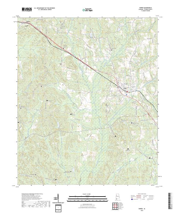
2024 Map of Gordo
USGS Topo · Published 2024About this map
Gordo serves as the central hub of this Pickens County landscape, situated where the road network converges amidst a complex system of local waterways. The terrain is defined by the winding paths of Bear Creek and Davis Creek, which weave through the agricultural and wooded surroundings. For those tracing family histories, the map is exceptionally dense with burial sites and rural congregations, ranging from the Gordo City Cem to more remote locations like the Salem Primitive Baptist Church Cem and Thrasher Cem. Smaller settlements such as Reform, Lathrop, and Bell are connected by a web of named local routes like Reform Gordo Rd and Elmore Center Church Rd, illustrating the persistence of established travel corridors in this part of Alabama. The mapping also highlights specialized areas such as the Greenhill Memorial Gardens and numerous church-affiliated cemeteries that anchor the local community structure.
Find a feature on this map
133 named features on this map. Tap any name to fly to it.
Don’t see what you’re looking for? This feature index may not catch every label — zoom into the map to look around manually.
Map Details
Editions of this 2024 Gordo Map
This is the sole edition of this map. No revisions or reprints were ever made.
Other maps of this area

1953 · Birmingham
USGS Topo · 1:250,000

1953 · West Point
USGS Topo · 1:250,000

1956 · Birmingham
USGS Topo · 1:250,000

1957 · Birmingham
USGS Topo · 1:250,000

1958 · West Point
USGS Topo · 1:250,000

1963 · West Point
USGS Topo · 1:250,000

1967 · Carrollton
USGS Topo · 1:24,000

1967 · Brownville
USGS Topo · 1:24,000

1967 · Gordo
USGS Topo · 1:24,000
1967 · Palmetto
USGS Topo · 1:24,000