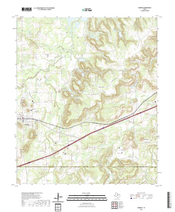
2022 Map of Gordon
USGS Topo · Published 2022About this map
Gordon serves as the primary hub of this North Texas landscape, where the street grid of the town center transitions into a network of ranch roads and water features. The area's history is preserved through a remarkable concentration of burial grounds, including the Old Gordon Cem and New Gordon Cem, as well as family-named sites like Swank Cem and Gibson Cem. The terrain is defined by isolated peaks such as Mitchell Mtn and Clayton Mtn, which rise above the drainages of Palo Pinto Creek and Barton Creek.
Find a feature on this map
80 named features on this map. Tap any name to fly to it.
Don’t see what you’re looking for? This feature index may not catch every label — zoom into the map to look around manually.
Map Details
Editions of this 2022 Gordon Map
This is the sole edition of this map. No revisions or reprints were ever made.
Other maps of this area

1890 · Stephenville
USGS Topo · 1:125,000

1891 · Palo Pinto
USGS Topo · 1:125,000

1918 · Palo Pinto
USGS Topo · 1:125,000

1920 · Stephenville
USGS Topo · 1:125,000

1925 · Palo Pinto 4-b
USGS Topo · 1:48,000

1931 · Santo
USGS Topo · 1:62,500

1954 · Abilene
USGS Topo · 1:250,000

1958 · Abilene
USGS Topo · 1:250,000
1959 · Lipan
USGS Topo · 1:62,500

1959 · Gordon
USGS Topo · 1:62,500