1984 Map of Gordon
USGS Topo · Published 1984About this map
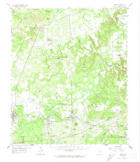
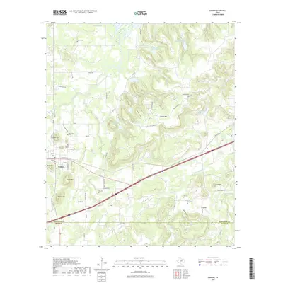
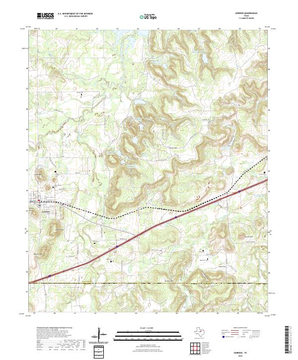
Gordon serves as the primary hub in this West Texas landscape, where the flatlands of the south meet the complex relief of the Clayton Mountain range. The settlement patterns here follow the rail and water routes, with small communities like Coalville and Blue Flat established near the winding course of Palo Pinto Creek. Further north, Lake Palo Pinto and Johnson Lake dominate the drainage system, while the terrain is defined by prominent peaks including Mitchell Mountain and Walters Mountain. The map reveals a specialized transit geography, evidenced by points like Gordon Junction and Judge Switch, which likely served as critical infrastructure for the area's movement of goods. Along the border of Palo Pinto and Erath County, the landscape transitions from the riparian corridors of Little Sunday Creek and Barton Creek into the upland heights of Deaton Mountain.
Find a feature on this map
28 named features on this map. Tap any name to fly to it.
Don’t see what you’re looking for? This feature index may not catch every label — zoom into the map to look around manually.
Map Details
Editions of this 1984 Gordon Map
This is the sole edition of this map. No revisions or reprints were ever made.
Historical Maps of Gordon Through Time
7 maps found