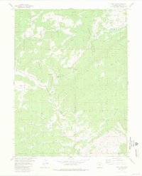
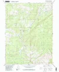
1980 Map of Gore Pass
USGS Topo · Published 1981About this map
Gore Pass serves as the central crossing point through this high-altitude landscape, where the boundaries of Arapaho National Forest and Routt National Forest meet. The 1980 survey captures a region primarily defined by its hydrology and recreation, featuring established sites like the Gore Pass Campground, Blacktail Creek Campground, and the Blacktail Creek Picnic Area. A complex network of drainages including Blacktail Creek, Gore Creek, and French Creek carves through the terrain, while Big Park provides a notable break in the timbered slopes.
Find a feature on this map
31 named features on this map. Tap any name to fly to it.
Don’t see what you’re looking for? This feature index may not catch every label — zoom into the map to look around manually.
Map Details
Editions of this 1980 Gore Pass Map
5 editions found
Other maps of this area

1933 · Mt. Powell
USGS Topo · 1:48,000

1940 · Mount Powell
USGS Topo · 1:62,500

1954 · Craig
USGS Topo · 1:250,000

1956 · Kremmling
USGS Topo · 1:62,500

1956 · Gore Pass
USGS Topo · 1:62,500

1957 · Craig
USGS Topo · 1:250,000

1957 · Leadville
USGS Topo · 1:250,000

1958 · Craig
USGS Topo · 1:250,000

1959 · Leadville
USGS Topo · 1:250,000

1960 · Leadville
USGS Topo · 1:250,000