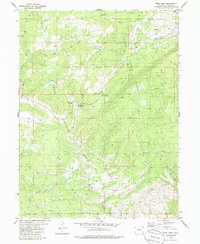
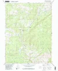
1980 Map of Gore Pass
USGS Topo · Published 1985About this map
Gore Pass serves as the topographic centerpiece of this 1980s mountain study, marking a divide where the Arapaho National Forest and Routt National Forest meet. The landscape is defined by its complex drainage systems, with Gore Creek, Blacktail Creek, and Rock Creek carving deep paths through the high terrain. Human presence is largely concentrated around seasonal infrastructure and transit, including the Gore Pass Campground and a network of jeep trails that navigate the slopes near Devils Slide.
Find a feature on this map
29 named features on this map. Tap any name to fly to it.
Don’t see what you’re looking for? This feature index may not catch every label — zoom into the map to look around manually.
Map Details
Editions of this 1980 Gore Pass Map
5 editions found
Other maps of this area

1933 · Mt. Powell
USGS Topo · 1:48,000

1940 · Mount Powell
USGS Topo · 1:62,500

1954 · Craig
USGS Topo · 1:250,000

1956 · Kremmling
USGS Topo · 1:62,500

1956 · Gore Pass
USGS Topo · 1:62,500

1957 · Craig
USGS Topo · 1:250,000

1957 · Leadville
USGS Topo · 1:250,000

1958 · Craig
USGS Topo · 1:250,000

1959 · Leadville
USGS Topo · 1:250,000

1960 · Leadville
USGS Topo · 1:250,000