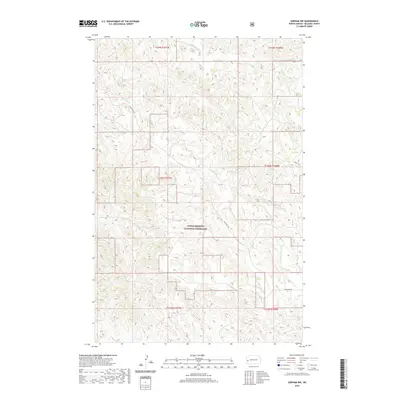
2020 Map of Gorham NW
USGS Topo · Published 2020About this map
The Little Missouri National Grassland dominates this corner of Billings County, preserving a complex drainage network where the North Dakota badlands begin to take shape. A series of deeply incised creek beds, including Whitetail Cr, Blacktail Cr, and Mikes Cr, carve through the high prairie, illustrating the erosive power that has sculpted this terrain over millennia. The map shows a landscape defined by the Public Land Survey System, with township and range lines such as t143n r101w and t144n r100w partitioning the open country. Limited human infrastructure is represented by primitive thoroughfares like Blacktail Rd and 16th St SW, which follow the contours of the high ridges to navigate between the branching draws and coulees.
Find a feature on this map
12 named features on this map. Tap any name to fly to it.
Don’t see what you’re looking for? This feature index may not catch every label — zoom into the map to look around manually.
Map Details
Editions of this 2020 Gorham NW Map
This is the sole edition of this map. No revisions or reprints were ever made.
Other maps of this area

1953 · Watford City
USGS Topo · 1:250,000

1957 · Watford City
USGS Topo · 1:250,000

1963 · Gorham SW
USGS Topo · 1:24,000

1963 · Gorham NW
USGS Topo · 1:24,000

1963 · Gorham SE
USGS Topo · 1:24,000

1963 · Gorham
USGS Topo · 1:24,000

1967 · Watford City
USGS Topo · 1:250,000

1970 · Hanks Gully
USGS Topo · 1:24,000

1970 · Wannagan Creek East
USGS Topo · 1:24,000

1970 · Roosevelt Creek East
USGS Topo · 1:24,000