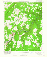
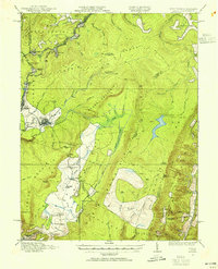
1949 Map of Gorman
USGS Topo · Published 1965About this map
The North Branch Potomac River serves as a winding political and geographic boundary in this 1940s survey, separating Maryland and West Virginia. Along its banks, the twin settlements of Gorman and Gormania represent a classic river-and-rail economy, anchored by the Western Maryland railroad that follows the valley floor. The landscape is dominated by the steep rises of The Backbone Mountain and Difficult Hill, where small farming communities and family homesteads are marked by a high density of rural burial grounds like the Harvey-Wilson Cem and Chisholm-Nydegger Cemetery.
Find a feature on this map
50 named features on this map. Tap any name to fly to it.
Don’t see what you’re looking for? This feature index may not catch every label — zoom into the map to look around manually.
Map Details
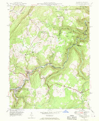
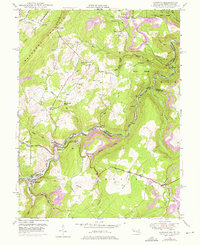
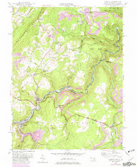
Editions of this 1949 Gorman Map
4 editions found
Other maps of this area

1895 · Piedmont
USGS Topo · 1:125,000

1899 · Oakland
USGS Topo · 1:62,500

1900 · Oakland
USGS Topo · 1:62,500

1916 · Davis
USGS Topo · 1:48,000

1918 · Davis
USGS Topo · 1:62,500

1919 · Elk Garden
USGS Topo · 1:48,000
1919 · Davis
USGS Topo · 1:62,500

1920 · Elk Garden
USGS Topo · 1:48,000
1920 · Davis
USGS Topo · 1:48,000

1921 · Greenland Gap
USGS Topo · 1:62,500