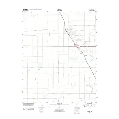
2012 Map of Goshen
USGS Topo · Published 2012About this map
Goshen sits at a critical transportation junction in the Central Valley, where major highway interchanges and rail corridors meet the sprawling agricultural grid of Tulare County. This 2012 survey shows the community as a vital logistics hub, anchored by the nearby Visalia Municipal Airport and Midvalley to the south. The landscape is a highly organized network of irrigation and industry, characterized by large-scale operations like Te Velde Bernard Dairy and historic ranching sites including Overland Ranch and Manzanillo Ranch. Water management is central to the area's layout, with Mill Cr and Packwood Cr cutting across the geometric road system. In addition to the commercial and transit infrastructure, the map details recreational and specialized land use, such as the Valley Oaks Golf Course and several numbered camps, including Camp Seven and Camp Eleven, which dot the landscape along the western approach to Visalia.
Find a feature on this map
67 named features on this map. Tap any name to fly to it.
Don’t see what you’re looking for? This feature index may not catch every label — zoom into the map to look around manually.
Map Details
Editions of this 2012 Goshen Map
This is the sole edition of this map. No revisions or reprints were ever made.
Other maps of this area

1925 · Tulare
USGS Topo · 1:31,680

1926 · Goshen
USGS Topo · 1:31,680

1926 · Burris Park
USGS Topo · 1:31,680

1927 · Traver
USGS Topo · 1:31,680

1927 · Monson
USGS Topo · 1:31,680

1927 · Remnoy
USGS Topo · 1:31,680

1927 · Paige
USGS Topo · 1:31,680

1927 · Visalia
USGS Topo · 1:31,680

1927 · Tulare
USGS Topo · 1:31,680

1928 · Waukena
USGS Topo · 1:31,680