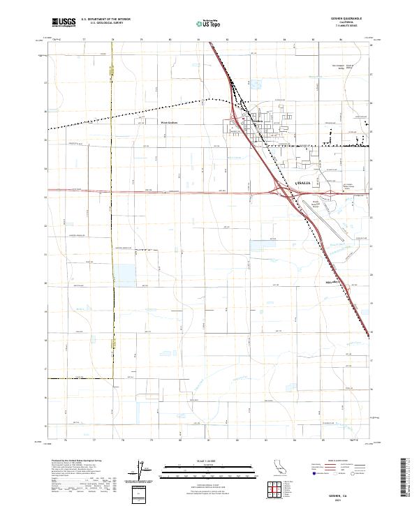
2021 Map of Goshen
USGS Topo · Published 2021About this map
The San Joaquin Valley agricultural landscape of Tulare County is defined here by an intricate system of water management, with the Tulare Canal and Packwood Cr cutting through the level terrain. The central intersection of highway and rail infrastructure has fostered the growth of Goshen and its neighbor West Goshen, serving as a transport node just west of the larger city of Visalia. This 2021 update shows the continued expansion of the city limits toward the Visalia Municipal Airport, where aviation and education meet at the San Joaquin Valley College - Visalia. While the area is increasingly industrial and suburban near the main interchanges, the grid of secondary roads like Hanford Armona Rd and Grangeville Blvd reveals the persistent irrigation patterns shaped by the S Fork Persian Ditch and Mill Cr Ditch.
Find a feature on this map
58 named features on this map. Tap any name to fly to it.
Don’t see what you’re looking for? This feature index may not catch every label — zoom into the map to look around manually.
Map Details
Editions of this 2021 Goshen Map
This is the sole edition of this map. No revisions or reprints were ever made.
Other maps of this area

1925 · Tulare
USGS Topo · 1:31,680

1926 · Goshen
USGS Topo · 1:31,680

1926 · Burris Park
USGS Topo · 1:31,680

1927 · Traver
USGS Topo · 1:31,680

1927 · Monson
USGS Topo · 1:31,680

1927 · Remnoy
USGS Topo · 1:31,680

1927 · Paige
USGS Topo · 1:31,680

1927 · Visalia
USGS Topo · 1:31,680

1927 · Tulare
USGS Topo · 1:31,680

1928 · Waukena
USGS Topo · 1:31,680