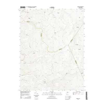
2014 Map of Goshen
USGS Topo · Published 2014About this map
Arvondale and Goshen sit within a landscape defined by the intricate headwaters of several major river systems in this 2014 survey. This region where Upshur Co, Webster Co, and Randolph Co converge is characterized by high ridges like Potato Knob and Haystack Knob. For genealogists, the map identifies several smaller family burial grounds, including Rice Cem near Canaan and the Vance Cem located in the southern reaches of the quadrangle. The settlement pattern follows the narrow valley floors, with places like Craddock and Suncrest linked by winding forest roads. The hydrological importance of the area is evident in the many converging forks, such as the Left Fork Holly River and the Right Fork Buckhannon River, which originate in these highlands.
Find a feature on this map
82 named features on this map. Tap any name to fly to it.
Don’t see what you’re looking for? This feature index may not catch every label — zoom into the map to look around manually.
Map Details
Editions of this 2014 Goshen Map
This is the sole edition of this map. No revisions or reprints were ever made.
Other maps of this area

1893 · Buckhannon
USGS Topo · 1:125,000

1896 · Buckhannon
USGS Topo · 1:125,000

1897 · Buckhannon
USGS Topo · 1:125,000

1912 · Sago
USGS Topo · 1:48,000

1912 · Crawford
USGS Topo · 1:48,000

1913 · Hacker Valley
USGS Topo · 1:48,000

1913 · Pickens
USGS Topo · 1:48,000

1914 · Sago
USGS Topo · 1:62,500

1914 · Crawford
USGS Topo · 1:62,500

1915 · Hacker Valley
USGS Topo · 1:62,500