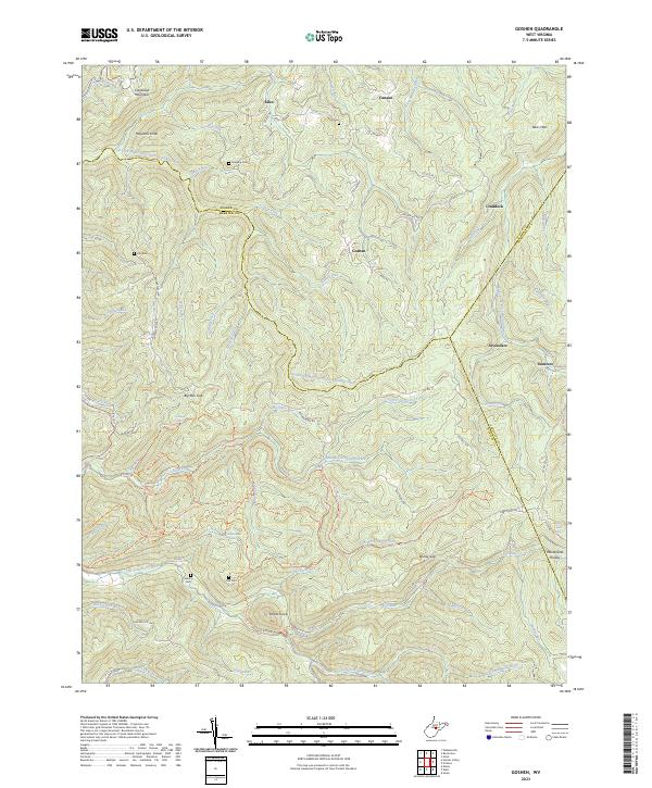
2023 Map of Goshen
USGS Topo · Published 2023About this map
The rugged highlands of the Webster, Upshur, and Randolph County borders define this remote landscape, where the Little Kanawha River and the Right Fork Buckhannon River find their headwaters. The settlement of Goshen sits at the center of a dense network of mountain hollows and ridges, connected by winding routes like Eden Rd and Mt Spring Rd. For family historians, several remote burial sites are documented across these peaks, including Rice Cem, Gregory Cem, and the simple Old Cem located near Potato Knob.
Find a feature on this map
85 named features on this map. Tap any name to fly to it.
Don’t see what you’re looking for? This feature index may not catch every label — zoom into the map to look around manually.
Map Details
Editions of this 2023 Goshen Map
This is the sole edition of this map. No revisions or reprints were ever made.
Other maps of this area

1893 · Buckhannon
USGS Topo · 1:125,000

1896 · Buckhannon
USGS Topo · 1:125,000

1897 · Buckhannon
USGS Topo · 1:125,000

1912 · Sago
USGS Topo · 1:48,000

1912 · Crawford
USGS Topo · 1:48,000

1913 · Hacker Valley
USGS Topo · 1:48,000

1913 · Pickens
USGS Topo · 1:48,000

1914 · Sago
USGS Topo · 1:62,500

1914 · Crawford
USGS Topo · 1:62,500

1915 · Hacker Valley
USGS Topo · 1:62,500