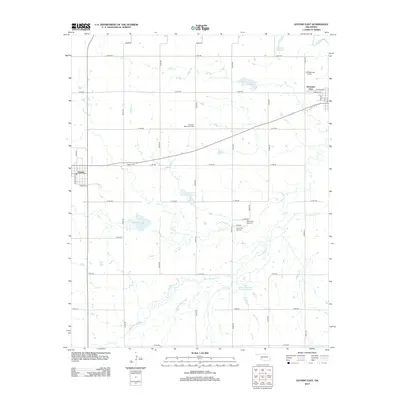
2013 Map of Gotebo East
USGS Topo · Published 2013About this map
The Washita River curves through the northeast corner of this Oklahoma landscape, anchoring a region defined by agricultural plots and water management. Several reservoirs, including Oak Cr Site 1 Reservoir and Rainy Mountain Cr Site 38 Reservoir, are scattered across the terrain to manage the flow of Rainy Mountain Cr and Sugar Cr. The map illustrates a high density of rural burial sites, providing significant genealogical value with locations like the Ebenezer Mennonite Cem and both the Rainy Mtn Old Cem and Rainy Mtn New Cem. Settlement is concentrated in Gotebo on the western edge and Mountain View to the east, connected by a network of section line roads. The proximity of these towns to the winding creeks and small-scale reservoirs highlights the vital role of local hydrology in shaping this Kiowa County community.
Find a feature on this map
40 named features on this map. Tap any name to fly to it.
Don’t see what you’re looking for? This feature index may not catch every label — zoom into the map to look around manually.
Map Details
Editions of this 2013 Gotebo East Map
This is the sole edition of this map. No revisions or reprints were ever made.
Other maps of this area

1949 · Cooperton
USGS Topo · 1:62,500

1950 · Saddle Mountain
USGS Topo · 1:62,500

1955 · Lawton
USGS Topo · 1:250,000

1955 · Clinton
USGS Topo · 1:250,000

1956 · Bally Mountain
USGS Topo · 1:24,000

1956 · Unap Mountain
USGS Topo · 1:24,000

1956 · Rainy Mountain Creek
USGS Topo · 1:24,000

1956 · Saddle Mountain
USGS Topo · 1:62,500

1956 · Cooperton
USGS Topo · 1:62,500

1957 · Clinton
USGS Topo · 1:250,000