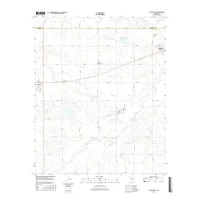
2016 Map of Gotebo East
USGS Topo · Published 2016About this map
Mountain View and Gotebo anchor this 2016 survey of the Oklahoma plains along the Washita River. The landscape is defined by the winding course of Rainy Mountain Cr, which feeds several flood control structures including Rainy Mountain Cr Site 38 Reservoir and Rainy Mountain Cr Site 29 Reservoir. This area in southwestern Oklahoma preserves a dense concentration of local heritage sites, particularly cemeteries that speak to the region's diverse settlement history.
Find a feature on this map
42 named features on this map. Tap any name to fly to it.
Don’t see what you’re looking for? This feature index may not catch every label — zoom into the map to look around manually.
Map Details
Editions of this 2016 Gotebo East Map
This is the sole edition of this map. No revisions or reprints were ever made.
Other maps of this area

1949 · Cooperton
USGS Topo · 1:62,500

1950 · Saddle Mountain
USGS Topo · 1:62,500

1955 · Lawton
USGS Topo · 1:250,000

1955 · Clinton
USGS Topo · 1:250,000

1956 · Bally Mountain
USGS Topo · 1:24,000

1956 · Unap Mountain
USGS Topo · 1:24,000

1956 · Rainy Mountain Creek
USGS Topo · 1:24,000

1956 · Saddle Mountain
USGS Topo · 1:62,500

1956 · Cooperton
USGS Topo · 1:62,500

1957 · Clinton
USGS Topo · 1:250,000