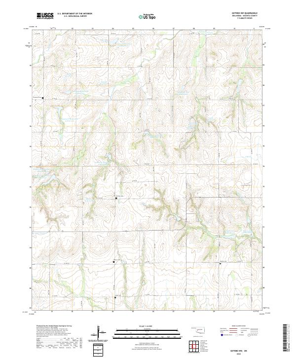
2022 Map of Gotebo NW
USGS Topo · Published 2022About this map
Strickland Cem and Elm Flat Cem are among several burial grounds preserved in this grid of section lines in Washita County. The landscape is defined by the headwaters of numerous watercourses, including the S Fork Cavalry Cr, Cloud Cr, and Oak Cr, which have been heavily modified by watershed management projects. A high concentration of numbered reservoirs, such as Cavalry Cr Watershed 9 Reservoir and Cavalry Cr Site 4 Reservoir, illustrates the modern hydraulic engineering used to manage runoff in these rural Oklahoma uplands.
Find a feature on this map
49 named features on this map. Tap any name to fly to it.
Don’t see what you’re looking for? This feature index may not catch every label — zoom into the map to look around manually.
Map Details
Editions of this 2022 Gotebo NW Map
This is the sole edition of this map. No revisions or reprints were ever made.
Other maps of this area

1955 · Clinton
USGS Topo · 1:250,000

1956 · Cordell
USGS Topo · 1:62,500

1957 · Clinton
USGS Topo · 1:250,000

1957 · Dill City
USGS Topo · 1:62,500

1961 · Gotebo
USGS Topo · 1:62,500

1961 · Hobart
USGS Topo · 1:62,500

1976 · Dill City SE
USGS Topo · 1:24,000
1983 · Dill City SE
USGS Topo · 1:24,000
1983 · Cordell
USGS Topo · 1:24,000

1983 · Cloud Chief
USGS Topo · 1:24,000