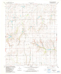
1984 Map of Gotebo NW
USGS Topo · Published 1985About this map
Strickland Cem and Elm Flat Cem anchor a landscape defined by traditional rural interment sites and water management in the mid-1980s. This Washita County terrain is marked by an extensive system of reservoirs, evidenced by numerous spillway elevations like those at Camp Spring Lake and along unnamed tributaries. The map documents the drainage patterns of South Fork Cavalry Creek and Cloud Creek, while recording the early industrial footprint of Gas Wells and scattered drill holes throughout the township lines. Genealogists will find particular value in the distribution of family or community burial grounds, including Rainey Cem, Odessa Cem, and Salem Cem, which serve as permanent markers of the area's agricultural settlement patterns during this era of Oklahoma history.
Find a feature on this map
23 named features on this map. Tap any name to fly to it.
Don’t see what you’re looking for? This feature index may not catch every label — zoom into the map to look around manually.
Map Details
Editions of this 1984 Gotebo NW Map
This is the sole edition of this map. No revisions or reprints were ever made.
Other maps of this area

1955 · Clinton
USGS Topo · 1:250,000

1956 · Cordell
USGS Topo · 1:62,500

1957 · Clinton
USGS Topo · 1:250,000

1957 · Dill City
USGS Topo · 1:62,500

1961 · Gotebo
USGS Topo · 1:62,500

1961 · Hobart
USGS Topo · 1:62,500

1976 · Dill City SE
USGS Topo · 1:24,000
1983 · Dill City SE
USGS Topo · 1:24,000
1983 · Cordell
USGS Topo · 1:24,000

1983 · Cloud Chief
USGS Topo · 1:24,000