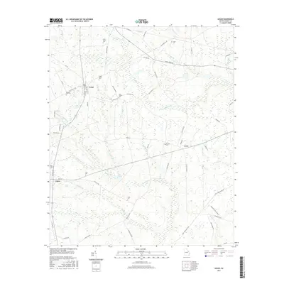
2017 Map of Gough
USGS Topo · Published 2017About this map
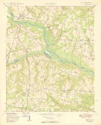
Gough and Vidette anchor this Burke County landscape, where the agricultural legacy of the Georgia coastal plain is clearly visible in the network of rural roads and scattered family burial grounds. The area is defined by its drainages, particularly Buckhead Cr and its various tributaries like Turner Br and Reubens Br, which carve gentle patterns through the terrain. A notable concentration of genealogy-rich sites exists here, including the Smith Family Cem, Gough Family Cem, and the uniquely named Joan Society Cem. The small settlement at Drone marks a crossroads near the center of the sheet, while ponds such as Hills Pond and Peel Pond dot the southern half of the quadrangle. This map documents a quiet rural pocket where the original land tracts and family names remain etched into the contemporary geography through road names like George Massey Rd and Floyd Farm Rd.
Find a feature on this map
64 named features on this map. Tap any name to fly to it.
Don’t see what you’re looking for? This feature index may not catch every label — zoom into the map to look around manually.
Map Details
Editions of this 2017 Gough Map
This is the sole edition of this map. No revisions or reprints were ever made.
Other maps of this area

1919 · Gough
USGS Topo · 1:62,500

1920 · Stapleton
USGS Topo · 1:62,500

1948 · Stapleton
USGS Topo · 1:62,500

1948 · Gough
USGS Topo · 1:62,500
1950 · Waynesboro
USGS Topo · 1:24,000
1950 · Gough
USGS Topo · 1:24,000
1950 · Storys Millpond
USGS Topo · 1:24,000
1950 · Keysville
USGS Topo · 1:24,000

1950 · Matthews
USGS Topo · 1:24,000

1950 · Kellys Pond
USGS Topo · 1:24,000