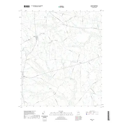
2020 Map of Gough
USGS Topo · Published 2020About this map
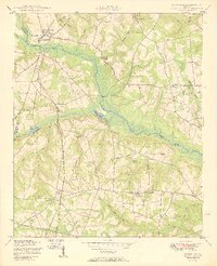
Gough and Vidette anchor this agricultural landscape in Burke County, where the terrain is defined by a dense network of black-water creeks and family burial grounds. The settlement at Drone sits at a crossroads further east, surrounded by a complex drainage system including Buckhead Cr, Rocky Cr, and Thornton Cr. Genealogists will find a high density of rural cemeteries such as Smith Family Cem, Gough Family Cem, and the uniquely named Joan Society Cem near Webster Rd. This area retains its traditional rural character, with scattered homesteads and family plots like Sheppard Place Cem and White Cem situated among the timberlands and fields. Water features like Hills Pond and numerous small tributaries such as Reubens Br and Lambert Br illustrate the hydraulic patterns of this Georgia coastal plain region.
Find a feature on this map
66 named features on this map. Tap any name to fly to it.
Don’t see what you’re looking for? This feature index may not catch every label — zoom into the map to look around manually.
Map Details
Editions of this 2020 Gough Map
This is the sole edition of this map. No revisions or reprints were ever made.
Other maps of this area

1919 · Gough
USGS Topo · 1:62,500

1920 · Stapleton
USGS Topo · 1:62,500

1948 · Stapleton
USGS Topo · 1:62,500

1948 · Gough
USGS Topo · 1:62,500
1950 · Waynesboro
USGS Topo · 1:24,000
1950 · Gough
USGS Topo · 1:24,000
1950 · Storys Millpond
USGS Topo · 1:24,000
1950 · Keysville
USGS Topo · 1:24,000

1950 · Matthews
USGS Topo · 1:24,000

1950 · Kellys Pond
USGS Topo · 1:24,000