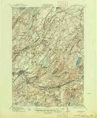
1915 Map of Gouverneur
USGS Topo · Published 1947About this map
Gouverneur serves as the focal point of this northern New York landscape, situated along the winding course of the Oswegatchie River. The region in the early twentieth century was defined by a complex network of rural education and small-scale industry, evidenced by the numerous district schools like Scotch Settlement School and Rock Island School that dotted the townships of DeKalb and Hermon. The industrial character of the era is captured at Fullerville Ironworks and the mining-adjacent settlements of Emeryville and Hyatt along the river branches.
Find a feature on this map
87 named features on this map. Tap any name to fly to it.
Don’t see what you’re looking for? This feature index may not catch every label — zoom into the map to look around manually.
Map Details
Editions of this 1915 Gouverneur Map
4 editions found
Other maps of this area

1904 · Ogdensburg
USGS Topo · 1:62,500

1905 · Ogdensburg
USGS Topo · 1:62,500

1906 · Brier Hill
USGS Topo · 1:62,500

1910 · Canton
USGS Topo · 1:62,500

1911 · Canton
USGS Topo · 1:62,500

1911 · Antwerp
USGS Topo · 1:62,500

1912 · Hammond
USGS Topo · 1:62,500

1913 · Lake Bonaparte
USGS Topo · 1:62,500

1915 · Gouverneur
USGS Topo · 1:62,500

1915 · Russell
USGS Topo · 1:62,500