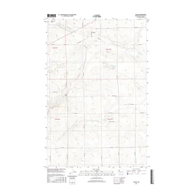
2017 Map of Govan
USGS Topo · Published 2017About this map
Govan sits at the northern edge of this map, marking a quiet point in the Lincoln County landscape where early twentieth-century roads like School House Rd and Bodeau Rd N intersect. The terrain is defined by a complex drainage network including Wilson Cr., Goose Cr, and the curious Sinking Cr, which feed into numerous small, isolated basins. These depressions form unique landmarks such as Hole in the Wall Lake, Bender Lake, and Nicholson Lake. South of the main settlement, Lewis Bridge spans the drainage near Union Valley Rd, while Fiddle Box Spring provides a named water source amidst a grid of rural routes. The landscape reflects the typical Palouse-adjacent distribution of family-named roads, such as John McKay Rd and Emil Johnson Rd, which reveal the agricultural and homesteading history of the region.
Find a feature on this map
37 named features on this map. Tap any name to fly to it.
Don’t see what you’re looking for? This feature index may not catch every label — zoom into the map to look around manually.
Map Details
Editions of this 2017 Govan Map
This is the sole edition of this map. No revisions or reprints were ever made.
Other maps of this area

1948 · Grand Coulee Dam
USGS Topo · 1:62,500

1948 · Wilbur
USGS Topo · 1:62,500

1950 · Wilbur
USGS Topo · 1:62,500

1950 · Grand Coulee Dam
USGS Topo · 1:62,500

1953 · Ritzville
USGS Topo · 1:250,000

1959 · Ritzville
USGS Topo · 1:250,000

1965 · Ritzville
USGS Topo · 1:250,000

1969 · Almira
USGS Topo · 1:24,000

1969 · Almira SE
USGS Topo · 1:24,000
1969 · Almira SW
USGS Topo · 1:24,000