
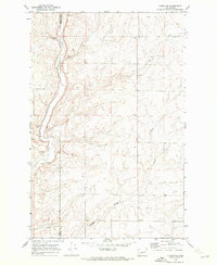
1969 Map of Almira SE
USGS Topo · Published 1972About this map
The high plateau of the Columbia Basin in Lincoln County defines this agricultural landscape as it was documented in the late 1960s. The terrain is characterized by a high concentration of Well and Spring sites, supporting the dryland farming operations that rely on the Grain Elevator and various Storage Bins scattered across the township. The drainage of Canniwai Creek and the small basin of Carpenter Lake provide the primary hydrological relief in an area dominated by intricate contour lines and basalt coulees. Local history and genealogy interests are represented by the Tolonen Cem, a small burial ground situated north of the creek, while the presence of multiple Gravel Pit locations indicates the local extraction industry used for road maintenance and regional development.
Find a feature on this map
8 named features on this map. Tap any name to fly to it.
Don’t see what you’re looking for? This feature index may not catch every label — zoom into the map to look around manually.
Map Details
Editions of this 1969 Almira SE Map
This is the sole edition of this map. No revisions or reprints were ever made.
Other maps of this area

1953 · Ritzville
USGS Topo · 1:250,000

1959 · Ritzville
USGS Topo · 1:250,000

1965 · Ritzville
USGS Topo · 1:250,000

1968 · Marlin
USGS Topo · 1:24,000

1968 · Pacific Lake
USGS Topo · 1:24,000

1968 · Sullivan Lake
USGS Topo · 1:24,000

1969 · Almira
USGS Topo · 1:24,000
1969 · Almira SW
USGS Topo · 1:24,000

1969 · Govan
USGS Topo · 1:24,000

1969 · Wagner Lake
USGS Topo · 1:24,000