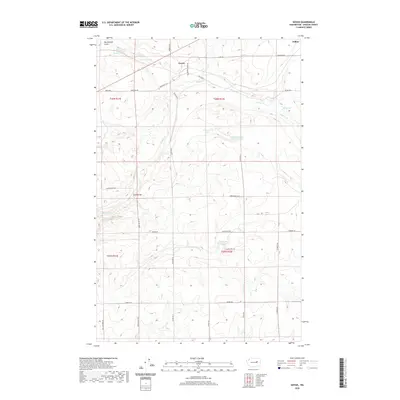
2020 Map of Govan
USGS Topo · Published 2020About this map
The settlement of Govan sits at a high point in this landscape of Lincoln County, where the dry plains of the Columbia Plateau are broken by complex coulees and seasonal water features. To the south, Lewis Bridge marks an important crossing point over Wilson Cr, a drainage system that defines much of the local topography alongside Goose Cr and Sinking Cr. The map reveals a land defined by its water sources, from the evocative Fiddle Box Spring to distinctive depressions like Hole in the Wall Lake and Nicholson Lake. The road network, including School House Rd and Fiddle Box Rd, follows the section lines of the Public Land Survey System, reflecting the organized agricultural settlement of this region. Sparse terrain features like Rattlesnake Gulch emphasize the basalt-carved character of the area northwest of Wilbur.
Find a feature on this map
37 named features on this map. Tap any name to fly to it.
Don’t see what you’re looking for? This feature index may not catch every label — zoom into the map to look around manually.
Map Details
Editions of this 2020 Govan Map
This is the sole edition of this map. No revisions or reprints were ever made.
Other maps of this area

1948 · Grand Coulee Dam
USGS Topo · 1:62,500

1948 · Wilbur
USGS Topo · 1:62,500

1950 · Wilbur
USGS Topo · 1:62,500

1950 · Grand Coulee Dam
USGS Topo · 1:62,500

1953 · Ritzville
USGS Topo · 1:250,000

1959 · Ritzville
USGS Topo · 1:250,000

1965 · Ritzville
USGS Topo · 1:250,000

1969 · Almira
USGS Topo · 1:24,000

1969 · Almira SE
USGS Topo · 1:24,000
1969 · Almira SW
USGS Topo · 1:24,000