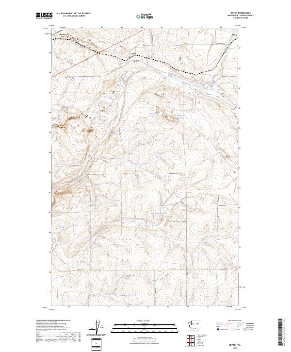
2023 Map of Govan
USGS Topo · Published 2023About this map
Govan sits at the heart of this Lincoln County landscape, a settlement positioned near the divide of several drainage systems. The terrain is defined by a network of seasonal coulees and small water bodies, including Nicholson Lake and the unusually named Hole in the Wall Lake. This area of the Columbia Plateau displays a classic dryland pattern of widely spaced farmsteads connected by a grid of rural roads like Govan Rd N and Scheibner Rd.
Find a feature on this map
36 named features on this map. Tap any name to fly to it.
Don’t see what you’re looking for? This feature index may not catch every label — zoom into the map to look around manually.
Map Details
Editions of this 2023 Govan Map
This is the sole edition of this map. No revisions or reprints were ever made.
Other maps of this area

1948 · Grand Coulee Dam
USGS Topo · 1:62,500

1948 · Wilbur
USGS Topo · 1:62,500

1950 · Wilbur
USGS Topo · 1:62,500

1950 · Grand Coulee Dam
USGS Topo · 1:62,500

1953 · Ritzville
USGS Topo · 1:250,000

1959 · Ritzville
USGS Topo · 1:250,000

1965 · Ritzville
USGS Topo · 1:250,000

1969 · Almira
USGS Topo · 1:24,000

1969 · Almira SE
USGS Topo · 1:24,000
1969 · Almira SW
USGS Topo · 1:24,000