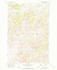
1969 Map of Government Hill SE
USGS Topo · Published 1973About this map
The Pine Hills dominate this section of Custer County, Montana, as documented by this late 1960s survey. The landscape is characterized by a complex network of seasonal drainages and essential water sources, including Chimney Springs and Fessler Springs, which were critical infrastructure for grazing and habitation in this semi-arid environment. The presence of Sunshine Camp suggests a history of organized activity or recreation amidst the elevated terrain.
Find a feature on this map
15 named features on this map. Tap any name to fly to it.
Don’t see what you’re looking for? This feature index may not catch every label — zoom into the map to look around manually.
Map Details
Editions of this 1969 Government Hill SE Map
2 editions found
Other maps of this area

1953 · Miles City
USGS Topo · 1:250,000

1957 · Miles City
USGS Topo · 1:250,000

1958 · Miles City
USGS Topo · 1:250,000

1969 · Horse Creek
USGS Topo · 1:24,000

1969 · Haines Springs
USGS Topo · 1:24,000

1969 · First Creek
USGS Topo · 1:24,000

1969 · Loaf of Bread Butte
USGS Topo · 1:24,000

1969 · Government Hill
USGS Topo · 1:24,000

1969 · The Knob
USGS Topo · 1:24,000

1969 · Buck Mountain
USGS Topo · 1:24,000