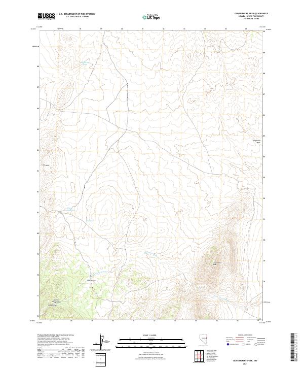
2021 Map of Government Peak
USGS Topo · Published 2021About this map
Government Peak stands as the primary landmark in this high-elevation corner of White Pine County, where the northern reaches of the Snake Range define the landscape. This 2021 survey reveals a complex network of drainage systems typical of the Great Basin's interior, including the expansive Indian George Wash and the northern White Cloud Wash. The geography is characterized by sharp relief and natural water sources such as Cain Springs, which likely served as critical waypoints in this arid environment.
Find a feature on this map
13 named features on this map. Tap any name to fly to it.
Don’t see what you’re looking for? This feature index may not catch every label — zoom into the map to look around manually.
Map Details
Editions of this 2021 Government Peak Map
This is the sole edition of this map. No revisions or reprints were ever made.
Other maps of this area

1956 · Ely
USGS Topo · 1:250,000

1959 · Ely
USGS Topo · 1:250,000

1963 · Ely
USGS Topo · 1:250,000
1986 · Mormon Jack Pass
USGS Topo · 1:24,000
1986 · Grass Valley Wash
USGS Topo · 1:24,000
1986 · Spring Mountain
USGS Topo · 1:24,000
1986 · White Cloud Point
USGS Topo · 1:24,000
1986 · Third Butte East
USGS Topo · 1:24,000
1986 · Government Peak
USGS Topo · 1:24,000
1986 · Tin Springs Mountain
USGS Topo · 1:24,000