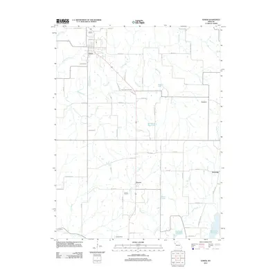
2012 Map of Gower
USGS Topo · Published 2012About this map
Gower stands as the primary hub in this Missouri landscape, situated at the junction of several rural routes and Old 169 US Hwy. The surrounding terrain is defined by a dense network of tributaries including Castile Creek, Linn Branch, and Roberts Branch, which flow toward the southern expanse of the Smithville Reservoir. This 2012 survey illustrates a transition in land use, where traditional agricultural settlements like Grayson and Scearces coexist with newer water management features like Morse Lake and Bill Woods Ranch Lake. For those researching local heritage, the map provides precise locations for long-standing community landmarks such as Antioch Cemetery, Allen Cemetery, and Mount Carmel Cemetery. The inclusion of a Landing Strip south of Grayson and the small cluster at Westbridge further reveals the modern infrastructure layered over this historically rural region.
Find a feature on this map
60 named features on this map. Tap any name to fly to it.
Don’t see what you’re looking for? This feature index may not catch every label — zoom into the map to look around manually.
Map Details
Editions of this 2012 Gower Map
This is the sole edition of this map. No revisions or reprints were ever made.
Other maps of this area

1890 · Kansas City
USGS Topo · 1:125,000

1894 · Kansas City
USGS Topo · 1:125,000

1894 · Independence
USGS Topo · 1:125,000

1914 · Smithville
USGS Topo · 1:62,500

1925 · Gower
USGS Topo · 1:62,500

1925 · Plattsburg
USGS Topo · 1:62,500

1936 · Kearney
USGS Topo · 1:48,000

1942 · Kearney
USGS Topo · 1:62,500

1945 · Kearney
USGS Topo · 1:62,500

1950 · Kansas City
USGS Topo · 1:250,000