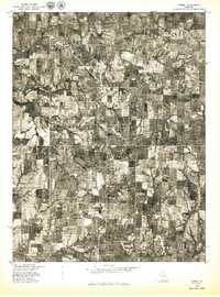
1978 Map of Gower
USGS Topo · Published 1978About this map
Gower sits at the junction of rail and road in this 1978 orthophotoquad, showing the town's grid and surrounding agricultural footprint in Northwest Missouri. The aerial perspective reveals a landscape of rectangular farm plots and wooded drainages along the winding Castile Creek. Small settlements like Grayson and Scearces appear as clusters of activity within this rural expanse, highlighting the distribution of local commerce and residency during the late 1970s. The southern edge of the survey is defined by the Little Platte, where the watercourse snakes through low-lying fields. This document, produced by the Geological Survey and the Soil Conservation Service, provides a clear view of land use, field boundaries, and the rural infrastructure that supported Clinton County during this era.
Find a feature on this map
5 named features on this map. Tap any name to fly to it.
Don’t see what you’re looking for? This feature index may not catch every label — zoom into the map to look around manually.
Map Details
Editions of this 1978 Gower Map
This is the sole edition of this map. No revisions or reprints were ever made.
Other maps of this area

1890 · Kansas City
USGS Topo · 1:125,000

1894 · Kansas City
USGS Topo · 1:125,000

1894 · Independence
USGS Topo · 1:125,000

1914 · Smithville
USGS Topo · 1:62,500

1925 · Gower
USGS Topo · 1:62,500

1925 · Plattsburg
USGS Topo · 1:62,500

1936 · Kearney
USGS Topo · 1:48,000

1942 · Kearney
USGS Topo · 1:62,500

1945 · Kearney
USGS Topo · 1:62,500

1950 · Kansas City
USGS Topo · 1:250,000