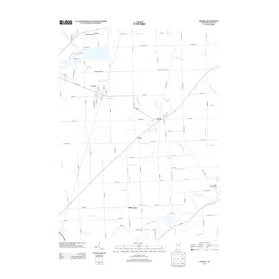
2013 Map of Grabill
USGS Topo · Published 2013About this map
The Saint Joseph River and Maumee River systems define the drainage of this northeastern Indiana landscape, where the legacy of the historic Wabash and Erie Canal remains visible near the Bull Rapids Bridge. The area is anchored by the settlement of Grabill, showing a distinct grid of streets like Indiana St and Main St near the Sawmill Rd industrial corridor. Smaller communities such as Harlan, Milan Center, and Hursh are connected by a dense network of country roads including Antwerp Rd and Notestine Rd.
Find a feature on this map
97 named features on this map. Tap any name to fly to it.
Don’t see what you’re looking for? This feature index may not catch every label — zoom into the map to look around manually.
Map Details
Editions of this 2013 Grabill Map
This is the sole edition of this map. No revisions or reprints were ever made.
Other maps of this area

1953 · Fort Wayne
USGS Topo · 1:250,000

1956 · Fort Wayne
USGS Topo · 1:250,000

1956 · Fort Wayne East
USGS Topo · 1:24,000

1956 · Cedarville
USGS Topo · 1:24,000

1957 · Auburn
USGS Topo · 1:24,000

1957 · Maples
USGS Topo · 1:24,000

1958 · Hicksville
USGS Topo · 1:24,000

1958 · Grabill
USGS Topo · 1:24,000

1958 · Woodburn North
USGS Topo · 1:24,000
1958 · Saint Joe
USGS Topo · 1:24,000