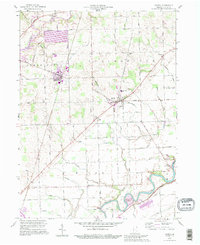
1992 Map of Grabill
USGS Topo · Published 1995About this map
The St Joseph River and Maumee River frame a landscape of organized agriculture and small rural crossroads in this northeast Indiana survey. The settlement of Grabill appears as a primary rail hub along the Norfolk and Western line, while the village of Harlan serves as a central junction for the surrounding townships. The intricate network of drainage features like Bull Rapids Ditch and Witmer Ditch illustrates the heavy reliance on engineered water management to maintain the productive tillable land in Springfield and Milan townships.
Find a feature on this map
74 named features on this map. Tap any name to fly to it.
Don’t see what you’re looking for? This feature index may not catch every label — zoom into the map to look around manually.
Map Details
Editions of this 1992 Grabill Map
This is the sole edition of this map. No revisions or reprints were ever made.
Other maps of this area

1953 · Fort Wayne
USGS Topo · 1:250,000

1956 · Fort Wayne
USGS Topo · 1:250,000

1956 · Fort Wayne East
USGS Topo · 1:24,000

1956 · Cedarville
USGS Topo · 1:24,000

1957 · Auburn
USGS Topo · 1:24,000

1957 · Maples
USGS Topo · 1:24,000

1958 · Hicksville
USGS Topo · 1:24,000

1958 · Grabill
USGS Topo · 1:24,000

1958 · Woodburn North
USGS Topo · 1:24,000
1958 · Saint Joe
USGS Topo · 1:24,000