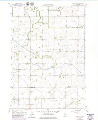
1958 Map of Gracelock NE
USGS Topo · Published 1980About this map
Shakopee Creek meanders through this portion of West Central Minnesota, serving as a primary drainage feature for the surrounding agricultural landscape. This 1958 survey, updated in the late 1970s, captures a transition in rural education and community organization as the townships of Torning, Cashel, Swenoda, Mandt, and Grace converge. The prevalence of numbered district schools, such as School No 2193 and School No 300, highlights a decentralized educational system that was characteristic of the era. The presence of St Johns Ch and scattered Gravel Pits reflects the social and extractive patterns of these rural communities. The map provides a detailed view of the sectional road grid and the boundary between Swift Co and Chippewa Co, documenting the land-use patterns before modern consolidation altered many of these local landmarks.
Find a feature on this map
17 named features on this map. Tap any name to fly to it.
Don’t see what you’re looking for? This feature index may not catch every label — zoom into the map to look around manually.
Map Details
Editions of this 1958 Gracelock NE Map
3 editions found
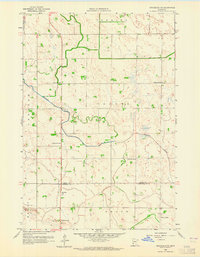
Other maps of this area

1953 · Saint Cloud
USGS Topo · 1:250,000

1957 · Saint Cloud
USGS Topo · 1:250,000

1958 · Saint Cloud
USGS Topo · 1:250,000

1958 · Murdock
USGS Topo · 1:24,000

1958 · Gracelock NE
USGS Topo · 1:24,000

1958 · Kerkhoven SW
USGS Topo · 1:24,000

1958 · Gracelock NW
USGS Topo · 1:24,000

1958 · Gracelock
USGS Topo · 1:24,000

1958 · Gracelock SW
USGS Topo · 1:24,000

1968 · De Graff
USGS Topo · 1:24,000