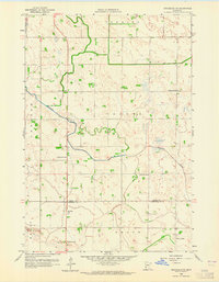
1958 Map of Gracelock NE
USGS Topo · Published 1965About this map
Shakopee Creek winds through the rural landscape of West Central Minnesota, crossing the boundary between Swift and Chippewa counties. This 1950s survey captures a highly organized agricultural district defined by its township grid, including portions of Torning, Cashel, Grace, Mandt, and Swenoda. The distribution of local landmarks suggests a landscape of small family farms, each served by a nearby rural education center.
Find a feature on this map
15 named features on this map. Tap any name to fly to it.
Don’t see what you’re looking for? This feature index may not catch every label — zoom into the map to look around manually.
Map Details
Editions of this 1958 Gracelock NE Map
3 editions found
Other maps of this area

1953 · Saint Cloud
USGS Topo · 1:250,000

1957 · Saint Cloud
USGS Topo · 1:250,000

1958 · Saint Cloud
USGS Topo · 1:250,000

1958 · Murdock
USGS Topo · 1:24,000

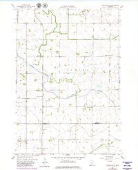
1958 · Gracelock NE
USGS Topo · 1:24,000

1958 · Kerkhoven SW
USGS Topo · 1:24,000

1958 · Gracelock NW
USGS Topo · 1:24,000

1958 · Gracelock
USGS Topo · 1:24,000

1958 · Gracelock SW
USGS Topo · 1:24,000

1968 · De Graff
USGS Topo · 1:24,000