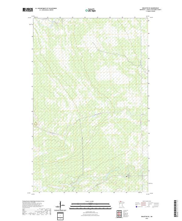
2022 Map of Graceton SE
USGS Topo · Published 2022About this map
The Rapid River winds through the southern reaches of this Lake of the Woods County landscape, providing the primary natural drainage for a region dominated by intricate wetland patterns. The terrain is defined by a systematic grid of forest roads and trails that facilitate travel through the dense north woods. Notable routes such as Stony Corners Trl and Pitt Grade Trl traverse the landscape, while Aichele Forest Rd provides access in the north. A significant point of local historical interest is the Hamilton Farm Cem, situated near the riverbanks. This small cemetery serves as a rare landmark of early settlement and family history within an area that remains largely undeveloped and characterized by its vast, water-heavy geography.
Find a feature on this map
14 named features on this map. Tap any name to fly to it.
Don’t see what you’re looking for? This feature index may not catch every label — zoom into the map to look around manually.
Map Details
Editions of this 2022 Graceton SE Map
This is the sole edition of this map. No revisions or reprints were ever made.
Other maps of this area

1919 · Peppermint Creek
USGS Topo · 1:62,500

1919 · G
USGS Topo · 1:62,500

1919 · Knutson
USGS Topo · 1:62,500

1921 · Baudette
USGS Topo · 1:62,500

1943 · Peppermint Creek
USGS Topo · 1:62,500

1954 · Roseau
USGS Topo · 1:250,000

1957 · Roseau
USGS Topo · 1:250,000

1958 · Roseau
USGS Topo · 1:250,000
1968 · Graceton SE
USGS Topo · 1:24,000
1968 · Baudette SW
USGS Topo · 1:24,000