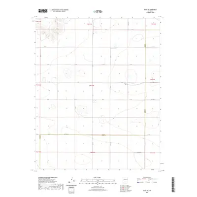
2020 Map of Grady SW
USGS Topo · Published 2020About this map
The high plains of eastern New Mexico define this 2020 topographic survey, primarily focusing on the section-line roads and drainage patterns of the Llano Estacado. The prominent boundary line of Quay Co Curry Co bisects the landscape, marking a jurisdictional divide across the agricultural tableland. Puerto Cr provides a rare break in the terrain, its drainage system cutting through the northern reaches of the quadrangle. The map is characterized by a dense grid of rural corridors, including Curry Road 41, Curry Road 38, and Curry Road 36, which follow the Public Land Survey System township and range lines. These routes illustrate the systematic settlement of the region, where roads such as Q R 40 and Q R 37 serve as the primary infrastructure for the dispersed ranching and farming operations that occupy the expansive New Mexican landscape.
Find a feature on this map
22 named features on this map. Tap any name to fly to it.
Don’t see what you’re looking for? This feature index may not catch every label — zoom into the map to look around manually.
Map Details
Editions of this 2020 Grady SW Map
This is the sole edition of this map. No revisions or reprints were ever made.
Other maps of this area

1954 · Clovis
USGS Topo · 1:250,000

1957 · Hammond Ranch
USGS Topo · 1:62,500

1958 · Clovis
USGS Topo · 1:250,000
1971 · Apache Canyon
USGS Topo · 1:24,000

1971 · Wheatland
USGS Topo · 1:24,000
1971 · Norton
USGS Topo · 1:24,000

1971 · Grady
USGS Topo · 1:24,000

1971 · Grady SW
USGS Topo · 1:24,000

1971 · Forrest
USGS Topo · 1:24,000
1973 · Field
USGS Topo · 1:24,000