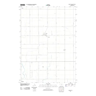
2010 Map of Grafton
USGS Topo · Published 2010About this map
Grafton sits as the central hub of this agricultural landscape in northern Iowa, where the Grafton Post Office serves the local rural community. The landscape is structured by a precise grid of county roads, including Warbler Ave and 390th St, which connect the town to outlying areas like Bolan to the northwest and Plymouth to the southwest. This era of land use is characterized by large-scale farming punctuated by small, localized landmarks such as the Trettin-Cole Airport and the Grafton Cemetery. Waterways including Rock Creek and the Shell Rock River provide the primary natural breaks in the geometric road pattern. For those studying family history, the inclusion of Schmidt Cemetery offers a specific point of interest for genealogical research in this part of Worth and Cerro Gordo counties.
Find a feature on this map
29 named features on this map. Tap any name to fly to it.
Don’t see what you’re looking for? This feature index may not catch every label — zoom into the map to look around manually.
Map Details
Editions of this 2010 Grafton Map
This is the sole edition of this map. No revisions or reprints were ever made.
Other maps of this area

1954 · Mason City
USGS Topo · 1:250,000

1957 · Mason City
USGS Topo · 1:250,000

1958 · Mason City
USGS Topo · 1:250,000

1959 · Mason City
USGS Topo · 1:24,000

1959 · Mason City
USGS Topo · 1:62,500

1959 · Nora Springs
USGS Topo · 1:24,000

1971 · Rudd
USGS Topo · 1:24,000

1972 · St. Ansgar
USGS Topo · 1:24,000

1972 · Osage SW
USGS Topo · 1:24,000

1972 · Manly
USGS Topo · 1:24,000