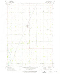
1972 Map of Grafton
USGS Topo · Published 1975About this map
Grafton serves as the central hub of this agricultural landscape in northern Iowa, situated at the intersection of local roads and the Chicago Milwaukee St Paul and Pacific railroad line. The map highlights a highly organized township system, divided into Barton, Newburg, and Union, where section lines dictate the placement of farmsteads and rural infrastructure. The Grafton Cem is positioned just south of the main town, providing a specific reference point for genealogical research in this portion of Worth County.
Find a feature on this map
19 named features on this map. Tap any name to fly to it.
Don’t see what you’re looking for? This feature index may not catch every label — zoom into the map to look around manually.
Map Details
Editions of this 1972 Grafton Map
This is the sole edition of this map. No revisions or reprints were ever made.
Other maps of this area

1954 · Mason City
USGS Topo · 1:250,000

1957 · Mason City
USGS Topo · 1:250,000

1958 · Mason City
USGS Topo · 1:250,000

1959 · Mason City
USGS Topo · 1:24,000

1959 · Mason City
USGS Topo · 1:62,500

1959 · Nora Springs
USGS Topo · 1:24,000

1971 · Rudd
USGS Topo · 1:24,000

1972 · St. Ansgar
USGS Topo · 1:24,000

1972 · Osage SW
USGS Topo · 1:24,000

1972 · Manly
USGS Topo · 1:24,000