
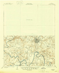
1927 Map of Graham
USGS Topo · Published 1927About this map
The Brazos River creates a serpentine landscape of dramatic oxbows and bends across Young County in the mid-1920s. This survey, which utilized aerial photography from the Army Air Service, captures a complex network of river crossings and rural infrastructure during a period of transition. The river's path is marked by distinctive features such as Gooseneck Bend and Miller Bend, where established crossings like McCann Bridge and Miller Bend Crossing facilitated local travel.
Find a feature on this map
47 named features on this map. Tap any name to fly to it.
Don’t see what you’re looking for? This feature index may not catch every label — zoom into the map to look around manually.
Map Details
Editions of this 1927 Graham Map
2 editions found
Other maps of this area

1890 · Breckenridge
USGS Topo · 1:125,000

1891 · Palo Pinto
USGS Topo · 1:125,000

1918 · Palo Pinto
USGS Topo · 1:125,000

1924 · Breckenridge 1-a
USGS Topo · 1:48,000

1924 · Palo Pinto 2-b
USGS Topo · 1:48,000

1924 · Graham 4-d
USGS Topo · 1:48,000

1925 · Graham 4-c
USGS Topo · 1:48,000

1925 · Breckenridge 1-b
USGS Topo · 1:48,000

1927 · Pickwick
USGS Topo · 1:62,500

1931 · Ivan
USGS Topo · 1:62,500