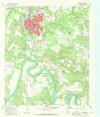
1967 Map of Graham
USGS Topo · Published 1970About this map
The Brazos River carves a dramatic path through the landscape south of Graham, Texas, forming the sharp meanders of Gooseneck Bend and Salem Bend. In the late 1960s, this region was a hub of energy and aviation activity, evidenced by the numerous oil and gas wells dotting the hillsides and the presence of the Municipal Airport. The northern portion of the sheet is anchored by the growing street grid of Graham, featuring essential community landmarks such as East Ward Sch, Shawnee Sch, and the Pioneer Cem.
Find a feature on this map
42 named features on this map. Tap any name to fly to it.
Don’t see what you’re looking for? This feature index may not catch every label — zoom into the map to look around manually.
Map Details
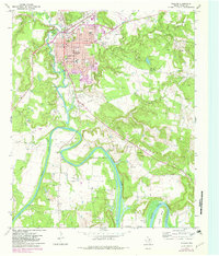
Editions of this 1967 Graham Map
2 editions found
Other maps of this area

1890 · Breckenridge
USGS Topo · 1:125,000

1891 · Palo Pinto
USGS Topo · 1:125,000

1918 · Palo Pinto
USGS Topo · 1:125,000

1924 · Breckenridge 1-a
USGS Topo · 1:48,000

1924 · Palo Pinto 2-b
USGS Topo · 1:48,000

1924 · Graham 4-d
USGS Topo · 1:48,000

1925 · Graham 4-c
USGS Topo · 1:48,000

1925 · Breckenridge 1-b
USGS Topo · 1:48,000

1927 · Graham
USGS Topo · 1:62,500

1927 · Pickwick
USGS Topo · 1:62,500