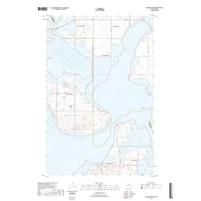
2017 Map of Grahams Island
USGS Topo · Published 2017About this map
Grahams Island dominates this 2017 survey of the intricate shoreline within Devils Lake. The landscape is defined by the high-water levels and fluctuating reaches of the lake, which isolate landmasses and create distinct aquatic features like Oswalds Bay and Pelican Lake. This modern topographic study, produced by the U.S. Geological Survey, shows a network of Bureau of Indian Affairs routes including BIA Rd 25 and BIA Rd 27 serving the southern portion of the island and surrounding shorelines. The map also delineates the complex county line between Benson Co and Ramsey Co, which weaves through the waters of Sixmile Bay. The presence of roads like Park Ave and a designated 4wd RD indicates the recreational and local access points established as the lake's footprint changed over recent decades.
Find a feature on this map
30 named features on this map. Tap any name to fly to it.
Don’t see what you’re looking for? This feature index may not catch every label — zoom into the map to look around manually.
Map Details
Editions of this 2017 Grahams Island Map
This is the sole edition of this map. No revisions or reprints were ever made.
Other maps of this area

1928 · Tokio
USGS Topo · 1:62,500

1931 · Oberon
USGS Topo · 1:62,500

1931 · Tokio
USGS Topo · 1:62,500

1931 · Devils Lake
USGS Topo · 1:62,500

1932 · Grahams Island
USGS Topo · 1:62,500

1950 · Grahams Island
USGS Topo · 1:62,500

1950 · Devils Lake
USGS Topo · 1:62,500

1950 · Oberon
USGS Topo · 1:62,500

1951 · Crow Hill
USGS Topo · 1:24,000

1951 · Oberon
USGS Topo · 1:24,000