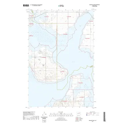
2020 Map of Grahams Island
USGS Topo · Published 2020About this map
Grahams Island dominates this part of Devils Lake, serving as a focal point for the complex shoreline where Benson and Ramsey counties meet. The landscape is defined by its erratic water boundaries, with Sixmile Bay to the east and the sheltered Oswalds Bay to the west. This modern survey illustrates the intricate relationship between the rising waters and the local infrastructure, showing how access routes like Park Ave and Co Rd 0322 navigate the island's interior. To the south and east, the road network transitions into Bureau of Indian Affairs routes, including BIA Rd 25 and BIA Rd 24, indicating the proximity of tribal lands. The map provides a clear record of the area's hydrology, from the main body of the lake to smaller features like Pelican Lake at the northern edge.
Find a feature on this map
24 named features on this map. Tap any name to fly to it.
Don’t see what you’re looking for? This feature index may not catch every label — zoom into the map to look around manually.
Map Details
Editions of this 2020 Grahams Island Map
This is the sole edition of this map. No revisions or reprints were ever made.
Other maps of this area

1928 · Tokio
USGS Topo · 1:62,500

1931 · Oberon
USGS Topo · 1:62,500

1931 · Tokio
USGS Topo · 1:62,500

1931 · Devils Lake
USGS Topo · 1:62,500

1932 · Grahams Island
USGS Topo · 1:62,500

1950 · Grahams Island
USGS Topo · 1:62,500

1950 · Devils Lake
USGS Topo · 1:62,500

1950 · Oberon
USGS Topo · 1:62,500

1951 · Crow Hill
USGS Topo · 1:24,000

1951 · Oberon
USGS Topo · 1:24,000