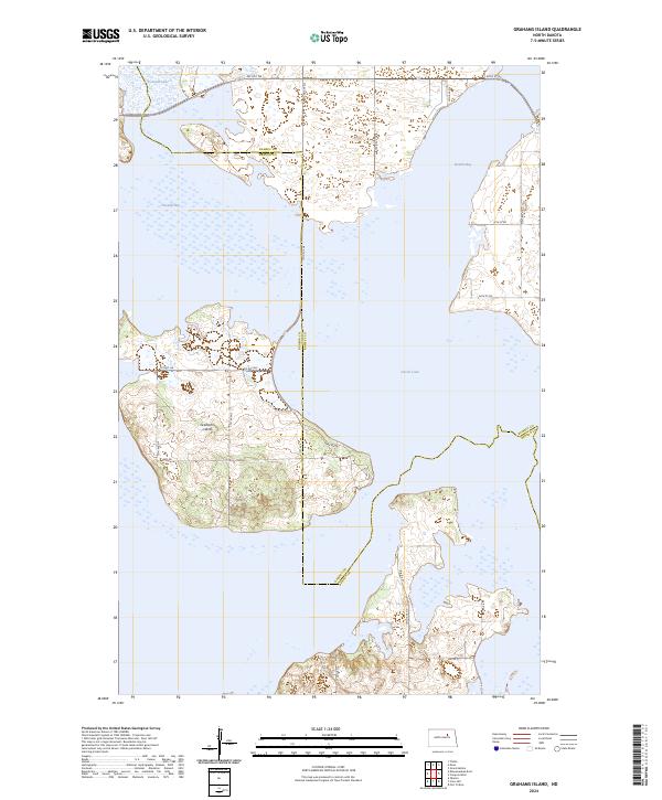
2024 Map of Grahams Island
USGS Topo · Published 2024About this map
Grahams Island dominates this Benson and Ramsey County landscape, surrounded by the shifting waters of Devils Lake. The map reveals a unique hydrographic environment where large bays such as Sixmile Bay and Oswalds Bay shape the island’s irregular coastline. The interior of the island is crisscrossed by local routes like Park Ave and Co Rd 0322, while the northern reaches transition toward Pelican Lake. This modern survey details the complex relationship between the rising lake levels and the terrestrial road network, including remote access points like 4wd RD. Further south, the landscape is marked by the presence of Bureau of Indian Affairs routes, including BIA Rd 25 and BIA Rd 27, which provide essential connectivity through the varied terrain near the water's edge.
Find a feature on this map
22 named features on this map. Tap any name to fly to it.
Don’t see what you’re looking for? This feature index may not catch every label — zoom into the map to look around manually.
Map Details
Editions of this 2024 Grahams Island Map
This is the sole edition of this map. No revisions or reprints were ever made.
Other maps of this area

1928 · Tokio
USGS Topo · 1:62,500

1931 · Oberon
USGS Topo · 1:62,500

1931 · Tokio
USGS Topo · 1:62,500

1931 · Devils Lake
USGS Topo · 1:62,500

1932 · Grahams Island
USGS Topo · 1:62,500

1950 · Grahams Island
USGS Topo · 1:62,500

1950 · Devils Lake
USGS Topo · 1:62,500

1950 · Oberon
USGS Topo · 1:62,500

1951 · Crow Hill
USGS Topo · 1:24,000

1951 · Oberon
USGS Topo · 1:24,000